 We spent the night across the road from Lucky Lake Recreational Waterslide Park just on the south side of the town of Watson Lake. There's a big, long slide back in the trees down this steep hill into the lake. It looks like lots of fun. When the Alaska Highway was built, the story is that one enterprizing young woman set up a tent beside this lake and went into business. Her callers referred to their business transactions as "a change of luck". Since then it has been known as Lucky Lake.
 It is in the Liard River Basin and we went on the 1.3 mile hike down the Liard Canyon to the river. There just seems to be rivers, creeks and lakes everywhere you turn up here and the creeks look like huge rushing rivers to us.
  In Watson Lake the next day, we visited the world famous Sign Post Forest which surrounds the Visitor's Center. It was started back in 1942 by an injured soldier who was working on the highway. He was recuperating from his injuries and his commander had him doing some painting. He painted a sign with his name, hometown and distance on it. Other soldiers started adding their signs to it and the rest is history. He and his wife visited 50 years later in 1992 when there were over 10,000 signs. The idea is so popular, it's been mimicked around the world.
 Now people from all over the world bring their own signs and add them. The town just keeps adding more posts whenever they are needed through an Adopt-a-Post program. There are over 72,000 signs now. Kathy, look close at this one and you will see something you will recognize. We also watched a movie across the street at the Northern Lights Center. They are best to see from late August to April, so we probably won't get to see them. I suppose it has to be dark. The sun is only down from about midnight to 4:00 and it never really gets dark here now.
 There are official city and highway signs and handwritten or painted signs on everything you can think of, such as tires, hub caps, pizza & pie pans, flip flops, t-shirts, bed pans, etc. I thought this one I saw was especially interesting, "The God who created all this is the God who loves us all. " Isaiah 40 2007.
This is the view right out the door of our camper at Big Creek Campground. There are wonderful little state campgrounds every 30 or 40 miles or so throughout the Yukon. They usually only have toilets and sometimes a water pump, but they only cost $12.00 and are almost always in a peaceful wooded area on a lovely river, creek or lake with hiking trails. Really very nice.

 This is a typical view of the highway as it keeps winding around the mountains and rivers.
  We stopped at Rancheria Falls Recreation Site and took a hike down to see the double falls. This is just one side of the falls as it goes around a big, rocky area in the middle. A very pretty area and well worth the hike.
  This is the Nisutlin Bay Bridge leading into the town of Teslin. The Nisutlin River forms the bay here as it flows into Teslin Lake. Teslin is native for "long, narrow water". Teslin Lake straddles the BC/Yukon border. It is 86 miles long and averages two miles across. Just across the bridge the Nisutlin Trading Post has the Yukon Wildlife Gallery in their gift shop with mounted grizzlies, moose, musk ox, mountain goats, etc.
  The George Johnston Museum here is also very nice. He was a native Tlingit (klinkit) here who ran a trading post and hunted and trapped. He ordered this 1928 Chevy and had it shipped in by barge when there were no roads here. He paid the locals to help him hack out several miles of woods and build a road. Then he charged them a quarter a mile for rides in his taxi to make the money back. In the winter he had frozen Teslin Lake to drive on. He had a camera and recorded the daily lifestyle of the natives from the 1930s -1950s. A very interesting little museum.
  This is the new Teslin Tlingit Heritage Center. It was just about closing time when we stopped, so we didn't go in, but it looked like it was very nice.
  View from our camper at Ten Mile Creek Campgroud,
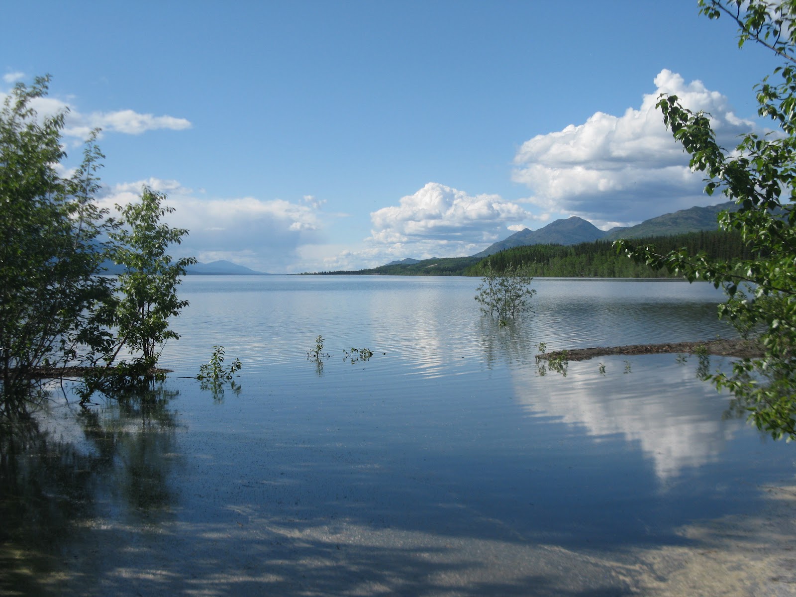 Boat launch area a short walk from Ten Mile Campground.
 Just another nice view along the road.
 This is Bennett Lake at Carcross on the BC/Yukon border. This is a little side trip off the Alaska Highway about 30 miles down toward Skagway. After climbing the Chilkoot or Whitepass Trail this is the lake where the Klondike Stampeders spent the winter building boats, so they would be ready to set off for the gold fields at Dawson City as soon as the ice broke in the spring. On May 29, 1898 when the ice broke, 10,000 stampeders came across the lake in 7,000 boats. They all had to check in with the Mounties. Fifteen Mounties with carbines and machine gun secured the summit. They collected over $150,000 in customs duties and had posts every thirty miles the entire gold rush route. There were very few violent crimes on the way or in Dawson City. Petty crimes got you hard labor cutting wood for the government or a "blue ticket" out of town on the next boat. They took no prisoners unless they had their own food supply. No one was allowed over the Chilkoot Pass without 1,000 lbs. of supplies plus tents and such. That's over ten trips up that steep trail carrying about 100 lbs. each time. 100,000 people started out, but only about 30,000 made it and very few of them found any great amount of gold.
  Carcross is a really neat little town, mostly all the old original buildings, including general store, hotel and train station. A sign in the general store said, "Shoplifters will be shot...This is the law of the Yukon. AND WE DON'T CALL 911". There are about five or six different options and combinations of train rides and bus rides that go from here to Skagway. I highly recommend checking them out. We didn't know there were so many choices until we got here and you had to book a day or two ahead, so we didn't go. We will be going to Skagway eventually anyway, but it would be a beautiful, scenic ride. This little bitty cabin was hardly any bigger than the outhouse. It was built by a miner who wanted
to have a place to stay in town over the winter from the 1940s-60s. He skiied into town in the winters and biked in the summers to get supplies and spend a little time in the beer parlour. It was just big enough for a small bed and a stove. Notice the little seat on the outside, so he would have a place to sit down.

There are lots of old cabins like this one where people are still living. Notice the built-on bathroom addition on the right side, newer chimney and bottle gas on the porch. Some even had satelite dishes. It's not uncommon for people to be living in these old cabins without indoor plumbing by choice.

There are lots of old cabins like this one where people are still living. Notice the built-on bathroom addition on the right side, newer chimney and bottle gas on the porch. Some even had satelite dishes. It's not uncommon for people to be living in these old cabins without indoor plumbing by choice.
 One last view of the village of Carcross as we leave town. The town was originally called Caribou Crossing for the seasonal migration of thousands of Woodland Caribou at the narrows, but was later shortened to Carcross. It was originally a Mounty Post and a First Nations village. Many homeowners here were considered "squatters" until 1983 when regulations were changed. The Whitepass & Yukon Railroad was completed in 1900 and ran until 1983. It was started back up in 1988 for tourists, and transports 500,000 tourists a year between May and September. We saw at least a dozen tour buses the couple hours we were here.
About a mile north of town the Carcross Desert, an unusual area of sand dunes affectionately known as the world's smallest desert, is not actually dry enough to be a real desert. It is sandy lake-bottom material left by a glacial lake.
 Just another view of the world's smallest desert. Scientists have found eight species of insects here that may be new to science.
 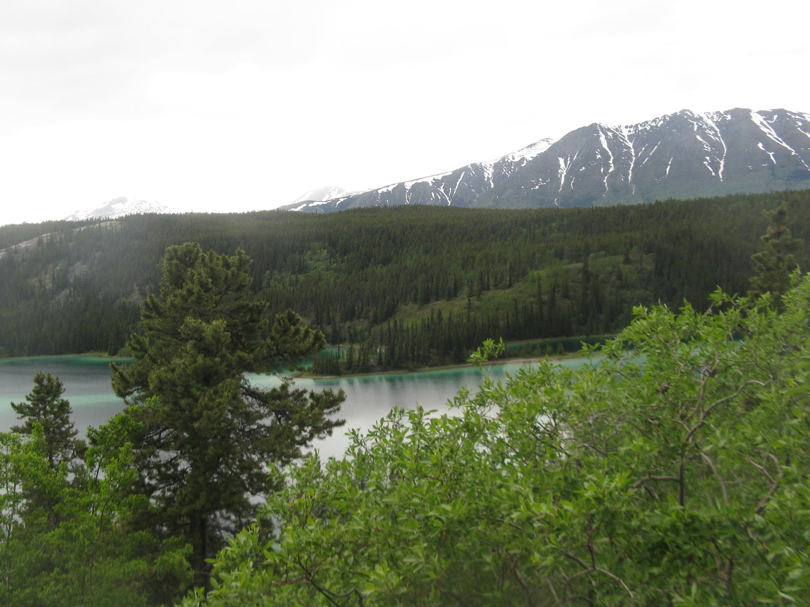 On our way back to the Alaska Highway, this is Emerald Lake, another of those blue/green colored lakes caused by the "rock flour" from the glaciers. It started to rain again while we were here. It seems like it has rained a lot, but it is good to wash the bugs off the windshield. They get bad in no time at all.
 We spent the night at Wolf Creek Yukon Government Campground just outside Whitehorse. This bear trap was set up in the campground, because they had a black bear that was frequenting the campground. The park ranger said they would have him in a day or two. Whitehorse blog tomorrow. I'm going to bed now. Even though it barely looks like dusk, it is 2:00 AM.
Goodnight All,
Tarra

No comments:
Post a Comment