 Alaska Highway, winding in and winding out, fills my mind with serious doubt, as to whether the "lout" who planned this route, was going to hell or coming out! A cute little poem I saw on a sign somewhere. It seemed appropriate. On Wednesday as we left Valdez and headed back up toward Thompson Pass, we passed a stretch of trees that only grow limbs on one side due to the extreme weather conditions here. Kind of strange looking.
  We stopped for a closer look at Worthington Glacier, and a short walk. This bike was in the picnic shelter there. I really like to bike, but I sure like the way we travel better, especially here where there are so many mountains and so much rain.
  If you look really close, you can see a couple people hiking way up on the left side about half way up to the glacier. They are just a little red and blue speck. Gives you some idea of the size of the glacier and the distance to hike up to it.
  I think this is the Klutina River near Copper Center. We drove all the way back to Tok and spent the night behind a gas station. The next day we filled up, washed the RV, had lunch and headed out.
  A pair of Trumpeter Swans on a pond along the road. Swans don't tolerate other swans (or humans) on "their" lake, but they coexist with muskrats, shorebirds and the only amphibian in Alaska, the wood frog. Alaska has no reptiles. The Trumpeter Swan mates for life and lives 15 to 25 years. It weighs 20 to 30 pounds and has a 6 to 8 foot wing span.
  This is the Tetlin National Wildlife Refuge in the Upper Tanana Valley. Sandhill Cranes migrate here and Trumpeter Swans live here.
  In 1982 there were only 56 Trumpeter Swans in the Upper Tanana Valley. Now there are thousands. They say there are a million lakes in Alaska and I believe it. Some are just ponds, but many are so large, that we drive along side them for many miles.
  Our Lady of Grace Catholic Church in the small town of Beaver Creek, just a few miles into the Yukon after we left Alaska. It was built in 1961 from a salvaged quonset hut left over from the Alaska Highway construction days. It is one of three Catholic missions on the north Alaska Highway. The others are in Burwash Landing and Haines Junction. Beaver Creek is the most westerly community in Canada. It is 4,700 miles from the most easterly community of Cape Spear, Newfoundland.
  We spent the night at Yukon Government Lake Creek Campground. The campground is in the trees just to the left of this picture and the Koidern River winds right around the edge of the campsites. View of the Kluane Mountain Range, which has nine of the sixteen highest peaks in Canada.
  This giant gold pan is next to the Kluane (klu-ony) Museum of Natural History at Burwash Landing, population 84, on Kluane Lake. The museum costs $3.00 and it's very good. It has lots of wonderful animal mounts, native artifacts and art, and includes a tour of the Catholic mission built in 1944 using an unfinished army mess hall, a log cabin and other leftover materials. The school was closed in 1952, but the church is still in use.
  This is down at the beach at Burwash Landing. Kluane Lake is the largest lake in the Yukon Territory covering 154 square miles. Just down the road, Destruction Bay, population 55, was one of the many relay stations during the building of the highway, placed every 100 miles or so to give the truck drivers a break. Named because of a storm that detroyed buildings and materials during highway construction.
  A little further down the road, another view of Kluane Lake. I took about a dozen pictures out the window as we were driving by and they all turned out great.
  It's hard to miss when your subject is so beautiful! It's so clear and clean. It looks so inviting. Too bad it's way too cold to get in and swim.
  We spent the night at Yukon Government Pine Lake Campground, three miles outside Haines Junction. This girl rode in on her bike and walked out to the end of the dock and just stood there. I know how she feels. Just another WOW moment.
  Oops, I guess I got momentarily distracted. That zoom is good for things besides just grizzly bears.
  Our Lady of the Way Catholic Mission, also converted from an old quonset hut by Father Morriset in 1943. I think he was responsible for the construction of all three missions. This one has the distinction of being the most photographed church in the Yukon. Notice the storage building in the back is also a quonset.
  View of Kathleen Lake from above, just a few miles south of Haines Junction. Kathleen Lake is home to a type of Salmon called the Kokanee, a sockeye that no longer returns to the ocean as part of it's life cycle. It became landlocked in the 1700s when Lowell Glacier surged across the Alsek River blocking it's drainage to the Pacific. It created an enormous lake. The dam broke in 1850 and the whole lake may have drained in a day. The Coastal Tlingit natives still tell of the tragic flood that swept many lives into the sea. The salmon were trapped and forced to adapt.
  Today they spend their first 3 years in Kathleen Lake. The fourth year they swim the short distance upstream to spawn in Sockeye Lake and die. The dam's been gone for 160 years, but the Kokanee still do not return to the ocean, living proof of Kluane's glacial past. They are the only natural occuring population of salmon in any Canadian National Park.
  A few miles down the road we stopped at Dezadeash Lake to hike a short, but interesting trail, according to the Milepost. We hiked about the half mile it was supposed to be. It started out as a boardwalk and went over a creek into the woods where it turned into a trail of wood chips. Then it started to head uphill with lots of tree roots, Finally we saw a couple flights of stairs and a landing at the top, so we figured we had made it to the observation platform.
 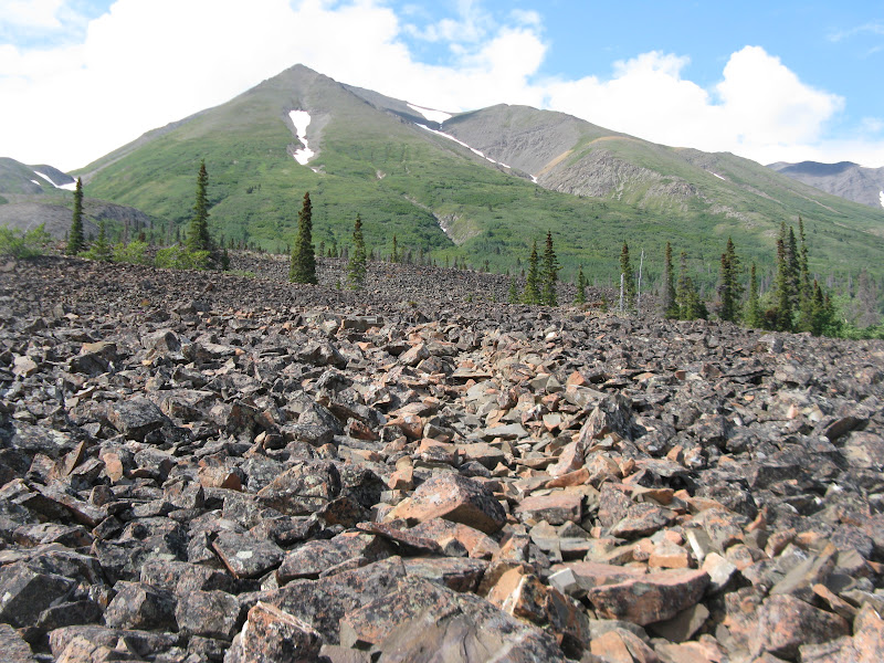 At the platform, this is what we saw. A very interesting trail indeed. A rock glacier born from bare rock and old glacial ice amid the rugged peaks of St. Elias Mountains. Once a trade route for the Tlingits, the trail climbs onto the toe of a rock glacier. There is a sort of switchback trail among the loose rocks just about up to where the grass starts.
  From there, the trail continues way up into the hills where you might very well encounter grizzlies. At the top of the rocks we met an older gentleman and his son from New Zealand and had a very nice visit, before we headed back down Rock Glacier Trail.
  Beautiful views of Dezadeash (DEZ-dee-ash) Lake for several miles aong the highway.
  Just a typical Alaskan with a big, old dog in the front seat, waiting for the pilot car, AGAIN. I guess I shouldn't say typical, because the average age in Alaska is 26.
  I thought the cloud above this mountain made it look like an erupting volcano. And another of those fun, winding roads, that are so typical of the Alaska Highway.
  Getting close to Haines now. This is part of the Alaska Chilcat Bald Eagle Preserve on the Chilcat River.
  In late fall 3,000 to 4,000 bald eagles congregate here to feast on the late run of chum salmon and fatten up for the winter. People come from all over the world to watch the spectacle.
  For a ten mile stretch just north of Haines, it is free camping in any pull out area you can find. So we picked a spot and spent the night before heading into town. Notice the sign.
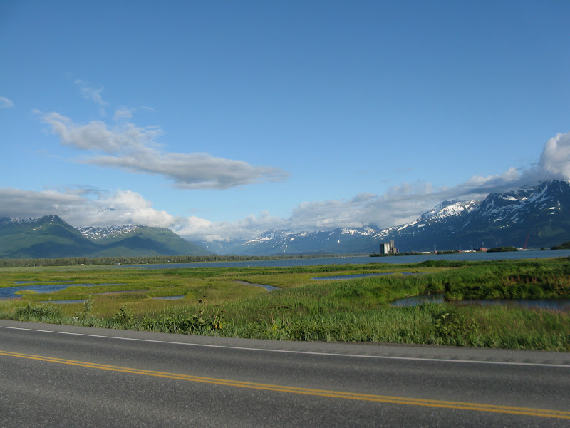
  View of the small boat harbor in Haines. We stayed at the Hitch-Up RV Park while we were in Haines. It's a very nice park about six blocks from downtown and the harbor.
 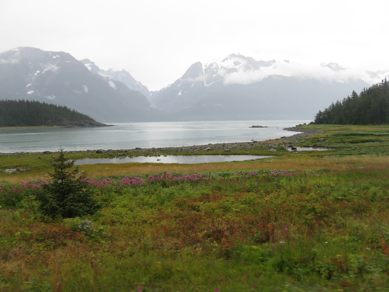 We drove ten miles out on Lutak road past the ferry harbor to watch the bears fishing where the salmon were running up river. Unfortunately, we didn't see any bears, just lots of people fishing and one seal swimming around.
  And some more very pretty scenery, of course.
  Just a little group of very rustic old buildings on main street.
  A war memorial in front of a church on main street. Seemed a little unusual. I don't think we've ever seen a war memorial in front of a church before.
 This is an owl at the American Bald Eagle Foundation Interpretive Center. They do rehab on injured birds.
  This is Scotty. He is a permanent resident, because his wing is too injured for him to ever be able to fly well enough to survive in the wild. So we got to watch his feeding and listen to a talk about eagles. They also have a very nice museum here with all kinds of animal mounts and birds, fish and other sea creatures.
  We had to check out the hammer museum. It was only $3.00 and they have over 1,500 different hammers. He had his collection at home, but his wife got fed up and told him he had to get rid of it, so he opened the museum. He claimed to be the only hammer museum in the world, but found out that some guy in Lithuania has started one, but it is much smaller.
  This is just one small corner, showing all the patents on different designs of hammers. John making his usual joke, asked if they had a wrench hammer. He said that's what they always used on the farm, when they couldn't find the hammer. But it turns out they actually had one. It is a wrench with a hammer head on the side of one end of the wrench.
  This is one he was inspired to create himself, when the octo-mom was so much in the news. Looks to me like this was about as smart an idea, as she and her doctor had. Probably the point he was trying to make. They also have an autographed hammer from Tim the Toolman Taylor (Tim Allen).
  I wonder if these really work? The husband trainer and the husband tamer. I doubt it, or there would be infomercials on TV, and they would be selling like hot cakes.
Tomorrow we will be taking a boat cruise over to Juneau for the day, and then heading for Skagway on the ferry Wednesday for a couple days. Then we will be leaving Alaska and heading back toward Montana to spend some time with our kids and grandkids before it gets too cold.
Tarra


