Tue, Aug. 28th - Thur, Aug. 30th
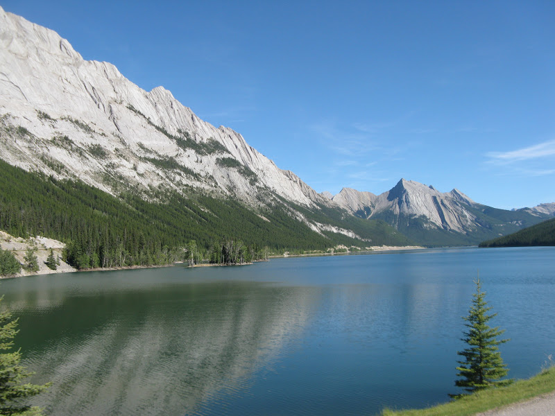
 After leaving Jasper National Park, we spent Monday night in the free overflow campground parking lot, just a couple miles south of the Lake Louise village. Tuesday we did the short hike that goes around half of Lake Louise. The other side of the lake is just a straight up mountain side, no place for a hiking trail. They had canoe and kayak rentals here.
  This little fellow wanted to pose, so I had to oblige him. I would have called him a chipmunk, but his picture was on a sign that called him golden-mantled ground squirrel.
  As we were hiking around the lake, we saw this group of trail riders on a trail above us.
  Just another view of the same cliff from our vantage point on the lower trail.
  A view looking back at the historic hotel, Chateau Lake Louise, from the end of the lake trail.
  There were several of these chandeliers in the hotel. I thought they were kind of unique. There were mountain climbers from Switzerland here way back in the 1899 (brought in by the railroad to promote the area) and I am guessing this is a Swiss design.
  There are 24 of these overpasses for large animals along this four lane divided highway. They are all sodded and treed with high fences along the sides and the high fences run along the sides of the highway for many miles.
  We stayed at Tunnel Mountain Campground Tuesday night in the town of Banff in Banff National Park. This is an interesting quote we saw, as we were checking out the restaurants downtown. It reminded me of something Benjamin Franklin once said, that I can't remember right now. It seemed like good advice anyway.
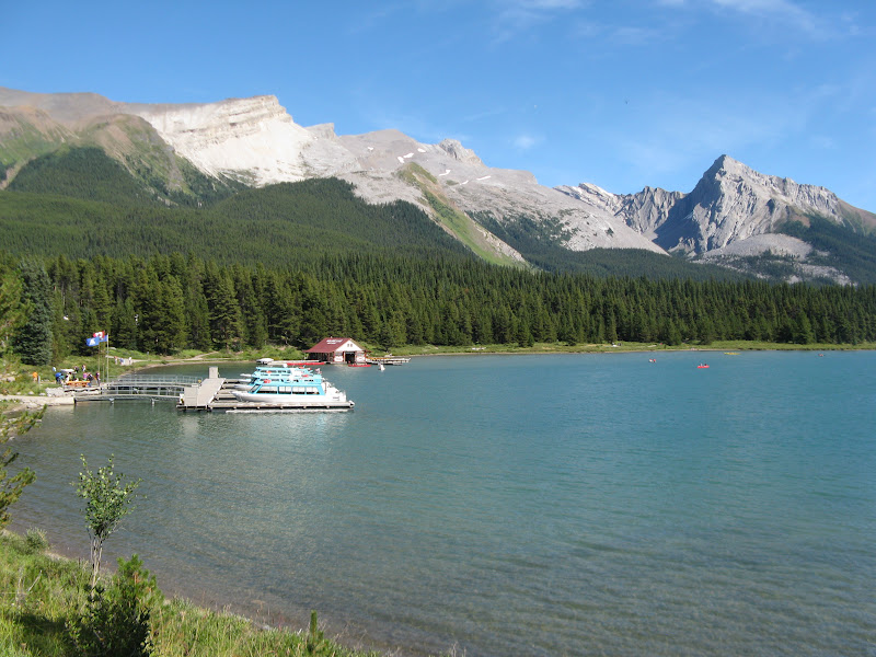
  This is a little lake at the bottom of Bow Falls with canoe and kayak rentals.
  This is Bow Falls right at the bottom of a hill with a huge, old historic hotel at the top of the hill.
  We were waiting for the stop light at this very heavy traffic intersection right in downtown Banff, when about thirty riders showed up, stopped traffic and proceeded across.
  John took me to Upper Springs, so I could soak in the hot springs pool, which had about 80 people in it while I was there. From the pool I could watch the gondolas going from the nearby ski area at Mount Norquay.
  The Cascade Gardens and Canadian Parks Administration Building, built for pennies a day by "relief workers" during the depression, as were many other historic buildings and projects during that time.
  John went to McDonald's to use their WiFi, while I walked down the street to enjoy the gardens.
  There were flag stone paths and burlwood bridges and picnic shelters throughout the many tiers of flower beds. We saw several burlwood factories as we were traveling. They make beautifull bowls and such out of this unique wood. A burl is a tree growth in which the grain has grown in a deformed manner resulting from some form of stress. It may be caused by an injury, virus or fungus. Most common causes are insect infestations and some types of mold infestations. Burls yield very peculiar and highly figured wood, prized for it's beauty and rarity which adds to it's expense.
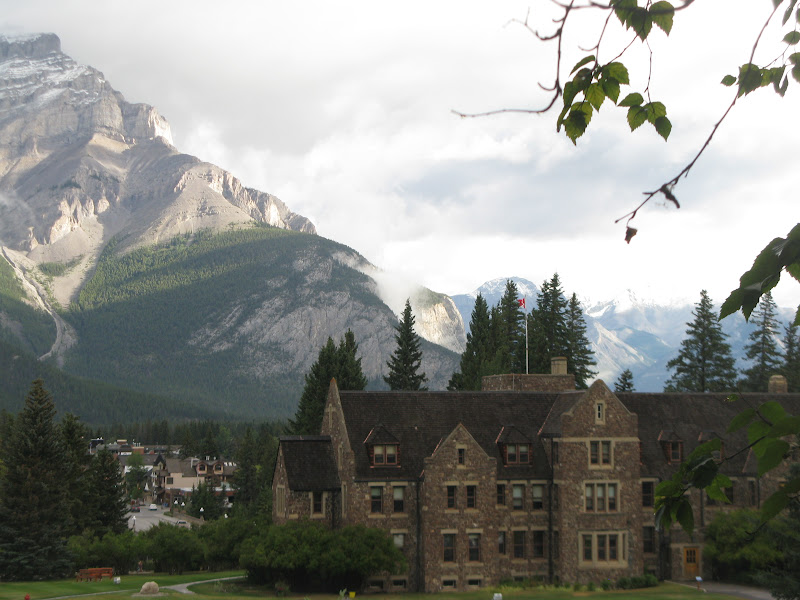 This is a view of the back side of the building looking back toward downtown Banff.
  A closer view of the Bow River Bridge, downtown main drag and Mount Rundle, named after an early missionary.
  Walking back downtown to meet John, a view of Bow River and a park and mountain to my left, as I crossed the Bow River Bridge.
  These next few views are of the the foothills of the Canadian Rockies between Banff and Waterton National Parks.
  The scenery was just gorgeous, as it changed from mountain peaks and glaciers to rolling hills with hay fields and an occasional wheat field.
  I've never seen so many hay bales. It looked like thousands of them stored on some of the farms or ranches.
  I couldn't believe how good these pictures turned out, just snapping them out my window as we drove by. Digital cameras are trully amazing!
  We checked into the Waterton Townsite Campground on Wednesday afternoon and went for a drive to do a little exploring. We drove the Akamina Parkway (about 10 miles) out to Cameron Lake where there are small fishing boats and paddle boats for rent.
  From here we did a short half mile hike to this nearby lake. Along this parkway road are several trailheads and the site of the first oil well in western Canada, discovered in the 1890s and abandoned in the early 1900s. They also have the Red Rock Parkway and the Bison Paddock Road (descendents from the original herd of Great Plains bison). Both were not recommended for big RVs.
  Driving back into town, we stopped to check out the Prince of Wales Hotel built in 1927 by the Great Northern Railway. It has great views of Upper Waterton Lake. From this dining area in the lobby they serve "high tea" every afternoon from 1:00 to 5:00 PM for $30. We were told it is a very impressive, fancy event, but the pastries and tea are really nothing special.
  A couple views of Upper Waterton Lake and the town below from the hotel. If you've ever thought about going on a bike tour and wondered where they spend the night, this is one of the places.
  There were several Backroads Bike Tours vans and trailers parked right behind me here. So there must have been a group of bicyclists spending at least one night here, probably several nights.
  From the town below looking back at the hotel on the hill.
  There is a walking trail here on Upper Waterton Lake, along the edge of town all the way to and through our campground. It's a cute little town, only about six blocks across each way, with little tourist shops and eating places.
  There was a group of five or six mule deer wandering around the campground, including two fawns.
  Babies are always so cute, no matter what species, and especially if they happen to be your very own grandchildren.
  Cameron Falls, also right in the campground. We went to a park ranger program at the Falls Theater in the campground.
  As we were leaving town on Thursday morning, we had to wait along with several other drivers, for this small group of Big Horn Sheep (females and babies) to decide to get off the road.
  A couple of last views over our shoulder, as we leave Waterton National Park.
  Heading down Chief Mountain Highway, we stop for the border crossing and head back into the good old U.S.A.
  We took the road around the east edge of Glacier National Park to Browning, Montana. Once again the scenery changes as we leave the Rockies behind and it gets way drier. I had noticed in Alberta that the mountains in the distance seemed quite hazy and wondered if they always looked that way in the distance.
  But as we got closer to Helena, the mountains got harder and harder to see. Then I knew there was a forest fire going on somewhere. Turns out it was in Idaho.
It was a really good trip and I highly recommend it. We really could have spent a couple more weeks, especially if we had brought the car with us, so we could have gone to some of the places where we couldn't go with the RV. We left Helena, Montana June 4th and returned on Aug. 30th. We traveled 7,487 miles total and bought 999.34 gallons of gas at an average price of $4.60. We drove 2,637 miles in Alaska and paid an average of $4.21 per gallon. We traveled 4,391 miles in Canada and paid an average of $5.05 per gallon. Groceries and eating out were quite expensive. A gallon of milk was over $5.00. The $10 Pizza Hut specials were $15. The $5 Subway footlongs were about $8. No wonder we meet so many Canadian Snowbirds down south in the winter. They save lots of money by spending the winter south, besides avoiding the cold weather. We will be staying with our kids and grandkids here in Helena until the first week in October. Then my family in North Dakota for a few days, Brookings for a couple days, Sioux Falls with our other daughter for a week, Iowa with friends for a few days and south toward Florida for the winter. Probably no more blogs until first part of November.
Over and Out,
Tarra