Monday, March 28th - Monday, April 4th

Crossing Alligator River Monday on our way to Roanoke Island and then the Outer Banks (OBX). The Alligator River National Wildlife Refuge on Dare Mainland is over 150,000 acres and is free.

Hwy. 12 heading south toward the Cape Hatteras National Seashore. It was established in 1953 and is America's first national seashore extending more than 70 miles south from Nags Head to Ockracoke Inlet. The shifting sand dunes require continuous plowing, just like year round snow storms, only warmer!

Walking the beach where we are staying at Camp Hatteras in the village of Waves in the Cape Hatteras National Seashore area near the center of the entire OBX collection of barrier islands. Our campground is just 3 miles south of Rodanthe where the movie Nights in Rodanthe (Nicholas Sparks book) was filmed with Richard Gere and Diane Lane.

The OBX string of islands from the Virginia border south to the Graveyard of the Atlantic Museum and Okracoke Island (connected by ferry) is about 130 miles long. It's not even a mile wide in most places with one main road through the center and about four houses deep on each side, to the beach on the Atlantic or the beach on on the Intracoastal Waterway side, including Currituck Sound, Croatan Sound and Pamlico Sound (north to south). Fort Raleigh is on the north end of Roanoke Island just across the sound from the Wright Brothers National Museum.

Tuesday we headed north to Kill Devil Hills to see the Wright Brothers National Museum. They started their flight tests in nearby Kitty Hawk the first year, but then moved here. There was no town here at the time, so the location was still described as Kitty Hawk. The location was chosen for the big hill, soft sand to cushion landings, strong winds and its lack of people, out of the public eye. The brothers owned a bicycle shop in Dayton Ohio which is where they worked out most of their mechanical ideas for flying, but the area was not suitable for test flights.

This boulder marks the spot where the plane is shown taking off in the picture above for their first 4 successful flights. The sand was too soft for them to take off from, so they built a rail for the plane to glide on as it built up speed for take off.

The brothers would each grab one of the propellers to start them going simultaneously and one of them would climb in the plane (taking turns). The plane was connected to a restraining wire that was then released and it would take off. They would run alongside steadying the wings as it gained speed to take off. Surfmen from the nearby Lifesaving Station would come to help when they were ready to do a test flight.

The buildings on the left are replicas of the hangars they worked from and stayed in during the several months they were here each autumn 1900 to 1903. In the far background on top of the hill is the monument to the brothers. The boulder marking where they took off from is just behind the three markers on the right. The three markers show how far the first three flights were. Way behind me is the marker for the distance of the 4th flight. In 1902 the brothers made about 1,000 glider flights off the hill, many into 35 mph winds, testing their ideas. Their record was 633 and 1/2 feet in 26 seconds. On Dec. 17, 1903, with their 12 HP, 200 pound plane, Orville made the first free, controlled and sustained flight in history at 10:35 AM going 120 feet in 12 seconds. It was the first time a manned, heavier-than-air machine left the ground by its own power, moved forward under control without losing speed, and landed on a point as high as that from which it started. Wilbur made the second flight of 175 feet in 12 seconds and Orville the third going 200 feet in 15 seconds. Wilbur made the fourth and final flight that day of 852 feet in 59 seconds. They returned in 1908 to fly their remodeled 1905 powered machine and in 1911 Orville set the world soaring record here that stood for ten years.

The hangars with the museum in the background. The museum is small, but they had an excellent Ranger talk explaining the first flight and a full-scale replica of the Wright Flyer. In 1969, only 66 years after that first ever 12 second flight, Neil Armstrong walked on the moon!

Walking up to the monument. In 1928 on the 25th anniversary there were 3,000 people gathered here from over 40 nations in this remote place to celebrate the birth of flight and the cornerstone for this monument was laid. In 1932 Orville Wright and Amelia Earhart were among the crowd of people here to dedicate the monument.

On top of Big Kill Devil Hill looking down toward the museum and the Atlantic Ocean.

I heard a little boy tell his Mom, "I know why they call it Kill Devil Hill, because this is where the people came to kill the devil." She told him no, but it sounds perfectly logical to me.

Hiking down the back side of the hill to see the new sculpture that was erected in 2003 for the centennial. Just to the left is a small airport where old style planes are taking off and landing occasionally. There are also lots of kids flying kites, which they are selling in the gift shop, of course.

This is a sculpture of the picture that was taken of the first flight, by one of their helpers from the life saving station. A piece of fabric from the 1903 Wright Flyer went to the moon with Neil Armstrong and he was here for the 100th anniversary unveiling of this sculpture to return it to the museum.

Next we drove further north through Kitty Hawk, Southern Shores, and Duck to Corolla to see the Currituck Beach Lighthouse. It is privately owned and costs $10 to climb it. We didn't because we were planning to climb one of the others that are in the national parks. Unfortunately, we found out later that they didn't open for climbing until April 15th for the season. I don't really recommend coming here much earlier than that because it's really not warm enough and a lot of the restaurants and shops aren't open. However, on the plus side, it wasn't very busy or crowded and it must be a mad house in the summer, judging by the number of restaurants, shops and vacation rental properties available. This distinctive brick beacon was built in 1875 to fill the last remaining dark spot on the North Carolina coast between Bodie Island and Cape Henry, Virginia where many ships foundered in the 80 mile navigational void at night. Each lighthouse had to have its own distinctive color or pattern to be easily recognized in the daytime. It is 160 feet tall and can be seen 18 miles out to sea, flashing at 20 second intervals as, it has since it was electrified in 1933.

View back toward the lighthouse. Next to the lighthouse is historic Corolla village with little shops in the original homes, a life saving station, the Wild Horse Museum and four-wheel drive tours of the Wild Horse Sanctuary where wild mustangs roam free (descendants of the horses the Spanish brought over). Signs warn you to stay on the boardwalk, because cottonmouth, or water moccasin snakes, are very venomous snakes here and also snapping turtles are not so nice. We stopped at Henry's Restaurant for the usual yummy fresh shrimp and called it a day.

Wednesday we drove all the way south to Hatteras Village to catch the free ferry to Okracoke Island. No reservations, you just show up and wait in line. Businesses with special passes get to go first, like the Lay's potato chip truck. We had to wait about an hour. When we came back in the afternoon there was no one waiting and the ferries run until midnight.

View along the 13 mile drive into the village of Okracoke after we got off the ferry. We had a really yummy lunch at Howard's Pub and Restaurant, some of the best shrimp I've had and John said it might be the best burger he's ever had, so ***** for Howard's! Definitely worth the long drive and ferry ride.

Driving around the little town checking out the sights. This little British cemetery is one of 500 in the U.S. where British soldiers are buried. The British Commonwealth War Graves Commission, established in 1917, marks and maintains graves they have in cemeteries all over the world in some 150 countries. They have representatives who check on all of them periodically to make sure they are being cared for. The Okracoke Coast Guard Station cares for this cemetery and holds a military honors ceremony here every year. I thought it was interesting that there were a bunch of dollar bills on top of one of the stones here being held down from the wind with a pile of coins. These four graves were the only four bodies found after the HMT Bedfordshire (one of 24 armed trawlers loaned to the U.S. Navy for coastal patrol in 1942) was sunk by a torpedo from German submarine U-558 in May 1942. In the spring of 1942 German U-boats prowled the ocean off the OBX sinking freighters at will. By June they had sunk 397 merchant vessels and the area had earned the nickname "Torpedo Junction". In October the U.S. Navy built a naval base in Okracoke Village to refuel anti-submarine patrol boats. Here at Okracoke Inlet is where British Lieutenant Robert Maynard, under orders from Virginia Governor Spotswood, killed Blackbeard (Edward Teach) while fighting with him aboard his ship, placing his head on the bowsprit of his own ship and throwing his body overboard. In battle, Blackbeard was a savage butcher with almost inhuman strength. He intimidated foes by wrapping slow-burning lighted coils in his long, black hair and beard. Wearing two gun belts across his chest and carrying six pistols into battle, he was an unforgettable enemy. Feared by everyone sailing the seas, including his peers, he was without conscience. "Kin to the devil," he showed no mercy as he stole from and often murdered those unfortunate enough to cross his path. After suffering 25 stab wounds and five bullets from the vicious battle, Blackbeard died. Legend holds his body swam several times 'round the ship before finally sinking from sight in the channel now known as Teach's Hole.

All up and down the OBX islands there are a variety of horse sculptures honoring the wild mustangs here. On Okracoke Island along the road to the village they have a pony pen with a viewing deck where you can stop and watch the 25 to 30 horses. There have been as many as 300 on the island and they were used by the residents for work and play. They were used by the U.S. Lifesaving Service until 1915 for beach patrols and to haul equipment to shipwreck sites and to patrol the beaches during WWII. During the 1950s they held annual July 4th pony round ups where some were branded and sold. In the late 1950s, the Okracoke Boy Scouts cared for the horses and had the only mounted troop in the nation. They are now cared for by the National Park Service and are occasionally ridden by park rangers patrolling the beaches.

Okracoke Lighthouse is 77 feet tall and emits a constant fixed beam that shines 14 miles out to sea across shallow Pamlico Sound on the Intracoastal Waterway and the Atlantic Ocean. Built in 1823, it is the second oldest operating lighthouse in the nation. Early in the Civil War the lens was dismantled by Confederate troops, but re-installed in 1864 by Union forces.

Heading back across Hatteras Inlet on the ferry. It is a 16 mile trip and takes about an hour. It actually only looks like a mile or so across from land to land, but due to all the sandbars and dangerous shoals, they have to follow a very circuitous path marked by buoys.

Thursday we went to Manteo on the north end of Roanoke Island. This is inside the visitor center at Fort Raleigh National Historic Site, site of the first English colony in the New World in 1585, also known as the Lost Colony. The paneling doors and ceiling in this room were shipped over from some home in England, to look like Sir Walter Raleigh's home. He was a favorite of Queen Elizabeth I and, along with some friends, financed several attempts at settlements here. In the early 1500s leading scientists, scholars and mariners gathered at Raleigh's Durham House in London to plan their settlement and you can watch and listen to him and his friends through the windows as they discuss their plans to finance settlements in the New World hoping to reap great profits.

This is a monument to The Lost Colony and the first child born here, Virginia Dare. It is truly beautiful and peaceful here walking around in the sheltered woods next to the beach. But I bet the mosquitoes were more of a problem than the Indians. Unless, of course, the Indians were responsible for their disappearance.

Setting for playwright Paul Green's annual outdoor productions of The Lost Colony. He wrote the play as a WPA project. Waterside Theater was built by the CCC on the banks of Albemarle Sound at Fort Raleigh National Historic Site. It plays six nights a week June through August. They have the spot marked where FDR sat when he attended the 23rd performance on Aug. 18, 1937. It has played continuously since then, except for a two year hiatus during WWII. It is the oldest outdoor drama in the country. Many people who have become famous have played prominent parts over the years, including Andy Griffith.

This is the view they had here from The Lost Colony settlement.

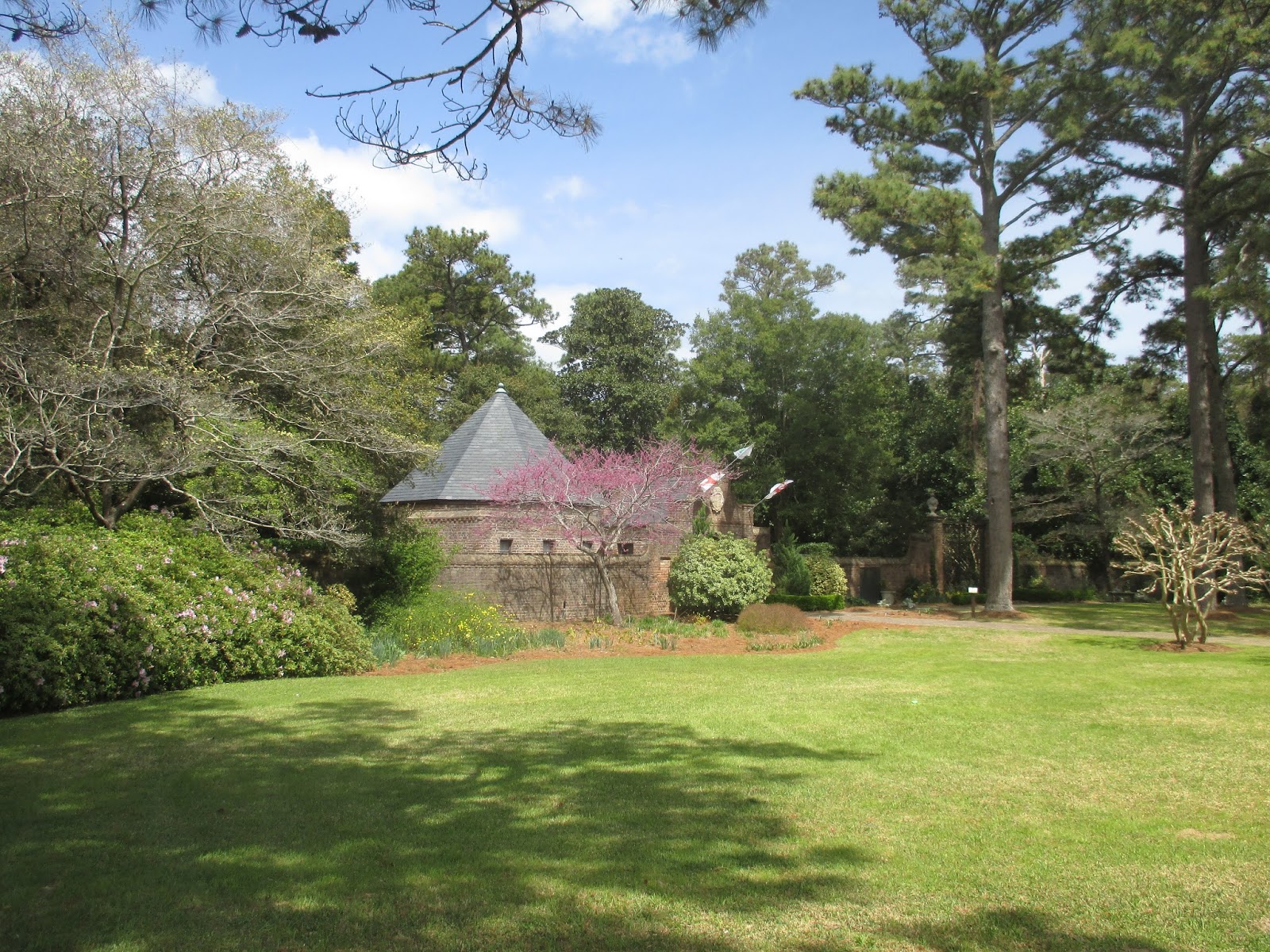
The Elizabethan Gardens are right next door to Fort Raleigh. They were created by the Garden Club of North Carolina (non-profit organization of 17,000 women) in 1951 as a living memorial to the first English colonists.

A quick tour of the highlights for all of my readers and John, who once again opted out on the gardens.

World's largest bronze statue of Queen Elizabeth I.

The carrara marble statue of Virginia Dare by Maria Louise Lander is an idealized vision of her. It was carved in Rome in 1859 and survived fire, shipwreck and public controversy to arrive as a gift from playwright Paul Green almost a century later. Virginia was the first child of the first colony of Elizabethan England in the New World.

View of the sound from the gardens.

In 1981 an authentic 16th century gazebo was built here overlooking the sound.

Pretty winding pathways with fragrant smells.

The ancient Italian statuary in the gardens came from the John Hay Whitney estate.

Weddings and other events are held here.

The ancient oak tree is believed to have been here in 1585.

Butterfly enjoying the sweet nectar of the azaleas.

These are really beautiful gardens and I'm sure they are even more stunning later in the spring as more flowers blossom.

Back to the beginning,

And the formal gardens with the statuary
Goodbye gardens, time to find some lunch. We also made a quick stop at Roanoke Island Festival Park which has a movie, museum, village, replica 16th century ship, re-enactments, etc. and boardwalk and lighthouse.

We drove to a few miles to Wanchese on the south end of Roanoke Island where the commercial fishermen bring in their catch everyday. We ate at O'Neal's Sea Harvest Market and Restaurant. Their display case was a work of art with all kinds of fresh sea creatures ready to be cooked for your delight. This little guy is a puffer fish. When threatened they can inflate to 3 times their normal size. There are 120 species of puffer fish from 1 inch to 3 feet long, also known as blow fish or toad fish. They are scaleless with spiky, rough skin. In Japan they are a very expensive delicacy despite being extremely poisonous. They can only be cooked by specially trained chefs who must cut it perfectly lest they poison their customers. The symptoms are dizziness, exhaustion, headache, nausea and eventually asphyxiation. They are the second most poisonous creature in the world after the golden poison frog. They are foul tasting and lethal to fish, but sharks can eat them and are not affected. They extend their razor sharp poisonous spikes that are highly toxic to humans and animals. Their poison is called tetrodotoxin and is 1,200 times more lethal than cyanide. One fish contains enough poison to kill 30 humans. No, we didn't try it!

Bodie Island Light Station (pronounced body) is 156 feet tall and can be seen 19 miles out to sea. The original one was on the south side of Oregon Inlet and was blown up in 1861 by retreating Confederate troops who feared the Union would use it to their advantage. This one was built in 1872 on the north side of the inlet near the northern border of the Cape Hatteras National Seashore just south of Nags Head. The keeper's quarters are now a visitor's center and there is a boardwalk through the surrounding marsh. It is not open for climbing. The village of Nags Head was named for land pirates who used to hang lights around the necks of the wild horses to confuse the ships as to where they were, so they would run aground on the dangerous shoals and sandbars. Then they could go out and loot the ships.

We stayed home Saturday and Sunday riding out what seemed like a mini hurricane. Monday we went to Jockey's Ridge State Park on Bodie Island, a National Natural Landmark, the became a 426 acre state park in 1975 to save the dunes from vacation condo development. Following its sighting by Spanish and French explorers, the ridge became an important landmark for mariners. It's the tallest natural sand dune system in the Eastern United States varying from 80 to 100 feet, depending on weather conditions. There is a one-mile, self-guided nature trail with interpretive panels and the Tracks in the Sand 1.5 mile, self-guided trail that starts with a 360-foot boardwalk behind the visitor center and small museum. That's where I took this picture from and you can see people trekking out to the dune and a couple people way out on top of the far dune. When lightning strikes sand dunes its incredible heat (approximately 15,000 degrees, twice as hot as the sun) melts the quartz sand into a glass tube, a fulgurite, often called petrified lightning.

The ridge contains 30 million tons of sand, about 6 million dump trucks full. All those trucks in a line would stretch almost all the way around the world. You can fly the same skies as Orville and Wilbur here, taking advantage of the OBX tall dunes and prevailing winds. Flying is very popular here with kites, model planes and gliders. It is world famous for hang gliding and they give thousands of lessons here every year.

The Monument to a Century of Flight at the visitor center in Kitty Hawk depicting 100 of the greatest achievements in aviation, dedicated in celebration of the soaring of the human spirit in 2003.

Our view from the Black Pelican ocean front cafe in Kitty Hawk. It was the original Kitty Hawk Life Saving Station built in 1876. In 1903 it served as the Western Union office from which the Wright brothers sent their message of a successful flight.

The Wright brothers ate here and I hope they enjoyed their meals as much as we did.

Several shopping parking lots have these giant beach chairs in varying colors marking different sections of the parking lot to help you remember where you parked. With more frequent senior moments happening every day, I loved it. I just hate it when I have to call John, as he waits for me in the car, to ask him where I am!

Friday and Saturday we hunkered down in the camper through what seemed like a mini hurricane. Sunday we drove back down to Hatteras Village where we drove by the Graveyard of the Atlantic Museum which was closed. They have exhibits about pirates, the Civil War ironclad the U.S.S. Monitor and shipwreck artifacts. Thousands of shipwrecks in this area gave it the reputation as the Graveyard of the Atlantic.

Just an example of what most of the homes look like on the OBX islands. A lot of them are vacations rentals for groups of up to 20 or 30 people and some families come every year for their reunions. We had shrimp and salad bar at the Quarter Deck Restaurant.

This is the lighthouse keeper's house on the right and the double keeper's house (assistants) on the left, where the current free year round museum is, but it was closed the day we were there, probably due to national park cut backs.

Cape Hatteras Lighthouse in Buxton is the tallest brick lighthouse in North America at 208 feet. It warns mariners of submerged and shifting sandbars that extend almost 20 miles off the cape into the Atlantic, known as the Diamond Shoals. Built in 1870, it is the international symbol of the North Carolina coast and you can climb it from mid-April to Columbus Day for a fee, $4 for seniors. Whale oil was replaced by kerosene in the 1880s and by 1943 the beam was electrified.

In 1999 the lighthouse was moved a half mile inland (2,900' southwest) to save it from the encroaching Atlantic. It was cut from its base, hydraulically lifted onto steel beams and traveled along railroad tracks to its current location over the course of 23 days at a cost of $9.8 million. This view of it is from where it used to stand.
Monday we moved to about an hour east of Richmond where we have been all week and will be leaving again on Monday toward Fredericksburg. Believe it or not, we saw a few snowflakes today. We must be moving north too fast.
See you'all soon,
Tarra
Monday we moved to about an hour east of Richmond where we have been all week and will be leaving again on Monday toward Fredericksburg. Believe it or not, we saw a few snowflakes today. We must be moving north too fast.
See you'all soon,
Tarra

Nice blog, keep sharing such informative blogs. Best security Shutters supplier offers high quality storm shutters & awnings in hampton roads, nags head, Virginia Beach, Suffolk & Newport News.
ReplyDeleteretractable awning Norfolk
I recently used Quality Blinds & Shades to purchase vertical drop screens for my home. The process was simple and the product was exactly what I was looking for.
ReplyDelete